Geocode a table
The code below uses the Toolbox SDK, which you can install with pip install toolbox-sdk.
Additional Python examples: using SDK, using Requests. If you prefer other programming language or need full API reference, check out Toolbox OpenAPI as well.
Docs
The tool processes addresses from a CSV file and adds its coordinates back to the file. A relevant geocoding license is needed.
Inputs:
Source file - table file (XLS(X),ODS,CSV,TXT) with a list of addresses. First row should contain field names. File should be in UTF-8 encoding;
Geocoder - specify one of the available geocoder providers. Note that only Nominatim is free, for others you need a license.
Address field name in source file;
API key to run the chosen geocoder. For Nominatim leave empty.
Note
How to get a geocoder API key
Google Geocoding API - https://developers.google.com/maps/documentation/geocoding/usage-and-billing
Outputs:
ZIP-archive with CSV file, containing two additional columns with latitude and longitude besides original data and GeoPackage containing a point vector layer;
Report on the number of records: total, processed and non-geocodable.
Example:
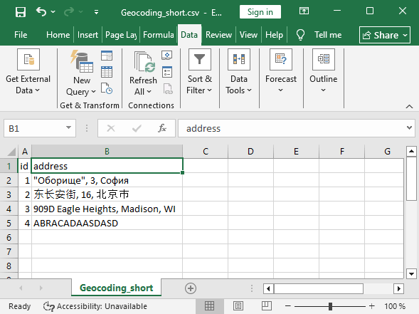
Example input
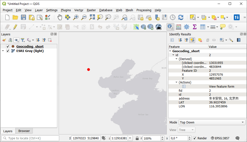
Example output
Try the tool in action
Click on the Demo button above the tool form. The fields are filled in with demo values.
Click on the Run button.