Geocode with Nominatim
The code below uses the Toolbox SDK, which you can install with pip install toolbox-sdk.
Additional Python examples: using SDK, using Requests. If you prefer other programming language or need full API reference, check out Toolbox OpenAPI as well.
Docs
Convert an address or place name to geographic coordinates and a bounding box using the OpenStreetMap Nominatim API.
Inputs:
Address / Place Name. Address or place name to geocode, e.g.
Basel, SwitzerlandorMarienplatz 1, München;Buffer (km). Expand the bounding box by this distance in km (default: 0). Useful to create a working area around a point address.
Outputs:
JSON string with west, south, east, north — directly usable as bbox input for other tools;
Human-readable geocoding result summary;
Full JSON manifest with coordinates, bbox, area, and metadata.
Example:
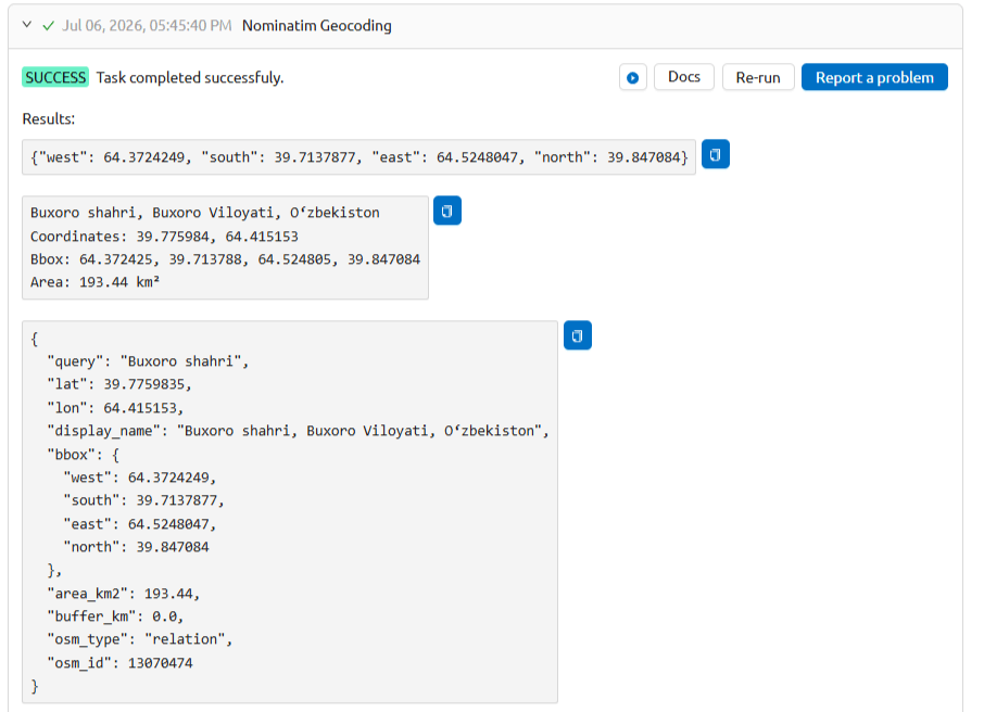
Example output
Try the tool in action
Click on the Demo button above the tool form. The fields are filled in with demo values.
Click on the Run button.