Set of squares with transects
The code below uses the Toolbox SDK, which you can install with pip install toolbox-sdk.
Additional Python examples: using SDK, using Requests. If you prefer other programming language or need full API reference, check out Toolbox OpenAPI as well.
Docs
This tool creates a set of square grids (polygons) and a transect for the territory.
Inputs:
Coordinates of the first point (center of the first cell), in decimal degrees, example
40.415378, -3.688743;Coordinates of the second point that indicates direction, in decimal degrees, example
40.417436, -3.683170;Side - on which side to generate the grid: right or left;
Cell count 1 - Number of cells on the first axis;
Cell count 2 - Number of cells on the second axis;
Cell size - The size of a cell’s side, in meters.
The result of the process is a set of layers:
rect1 - a grid of cells “Size 1” by “Size 2”, the center of the first cell is at the point 1;
rect2 - a grid of smaller cells (i.e. each large cell is divided into 4 parts);
line1 - transect lines in the direction perpendicular to the line between points 1 and 2;
line2 - transect lines in the direction parallel to the line between points 1 and 2;
centers - cell centers of rect1 grid.
Styles for all the layers are also included as QML files.
View the results on an interactive map: https://demo.nextgis.com/resource/4582/display?panel=layers
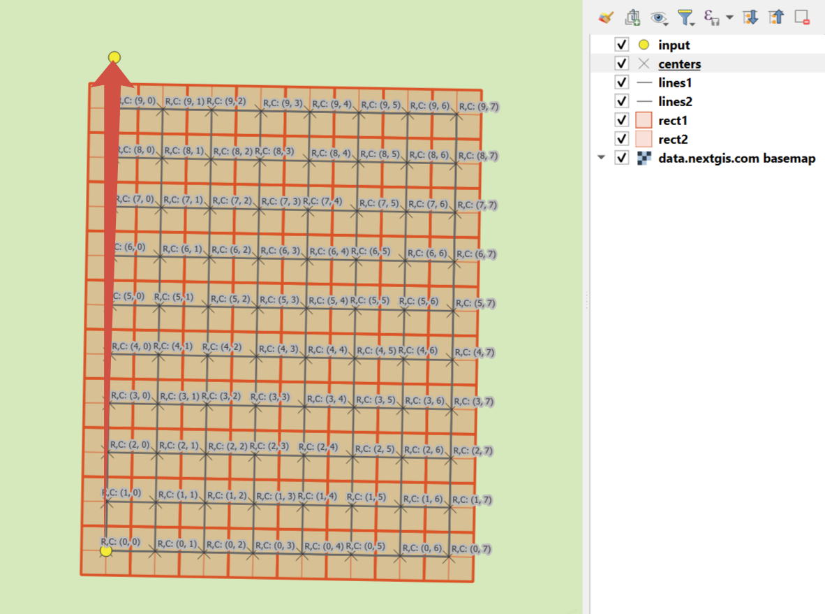
An example of the results
Try the tool in action
Click on the Demo button above the tool form. The fields are filled in with demo values.
Click on the Run button.