Reproject coordinates
The code below uses the Toolbox SDK, which you can install with pip install toolbox-sdk.
Additional Python examples: using SDK, using Requests. If you prefer other programming language or need full API reference, check out Toolbox OpenAPI as well.
Docs
Tool reprojects coordinates of the objects, presented in CSV file, into a given coordinate system.
Inputs:
CSV file - file with a list of objects and its coordinates
X coordinate column number - index number of the column in CSV file, where X coordinates are located (longitude).
Y coordinate coordinate column number - index number of the column in CSV file, where Y coordinates are located (latitude).
ID of the first row - index number of the row, from which reprojection should be applied.
Source CRS - coordinate reference system, used in source CSV. Should be specified in proj4 format (e.g.
+proj=longlat +ellps=WGS84 +datum=WGS84 + no_defs).Target CRS - coordinate reference system into which data will be reprojected. Should be specified in proj4 format (optional, by default
+proj=longlat +ellps=WGS84 +datum=WGS84 + no_defswill be applied).
Output:
CSV with added reprojected coordinates.
Example:
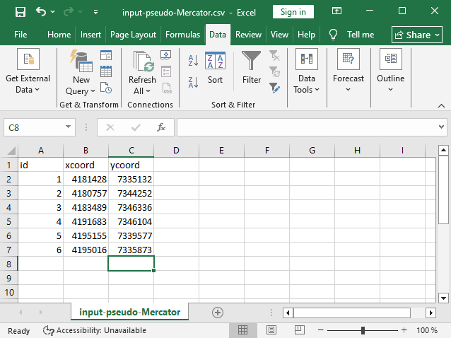
Example input
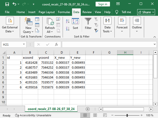
Example output: added columns with reprojected coordinates
Try the tool in action
Click on the Demo button above the tool form. The fields are filled in with demo values.
Click on the Run button.