Add region and settlement names in attributes
The code below uses the Toolbox SDK, which you can install with pip install toolbox-sdk.
Additional Python examples: using SDK, using Requests. If you prefer other programming language or need full API reference, check out Toolbox OpenAPI as well.
Docs
Appends attributes with administrative division and settlement names to any vector layer features. Uses data.nextgis.com extract as input source of region and settlement names.
Inputs:
Vector file - Geopackage, GeoJSON file or zipped ESRI Shapefile;
Zip file with data extract from data.nextgis.com;
Output name (optional).
Outputs:
GeoPackage file containing data with added attributes;
CSV file with the same data.
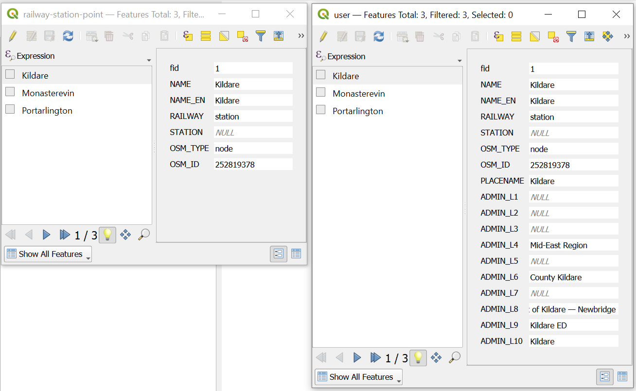
Initial data and the same data with added attributes
Try the tool in action
Click on the Demo button above the tool form. The fields are filled in with demo values.
Click on the Run button.